 By

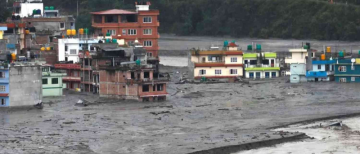
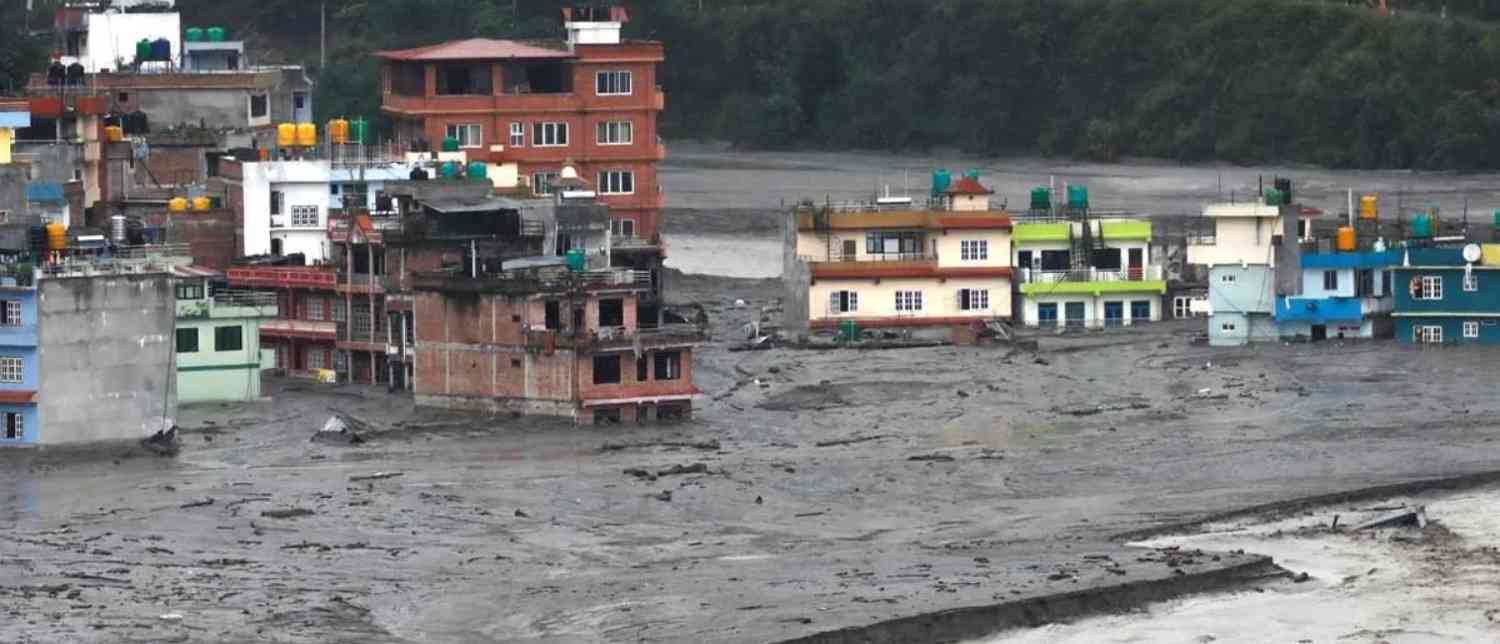
A sudden glacial lake outburst in Bhutan has triggered a major flood alert across parts of West Bengal and Assam, putting thousands of residents in downstream areas on high alert. Authorities have launched extensive evacuation operations as a massive volume of water flows towards the Sankosh River, raising concerns about potential flash floods along the India-Bhutan border.
The incident occurred on Thursday evening, October 29, at Shintaphu Lake in Bhutan's Gasa district. The sudden release of water sent a powerful surge downstream through the Mo Chhu River, which eventually feeds into the Sankosh River system. The development prompted emergency measures in vulnerable areas of North Bengal and neighbouring Assam, with disaster response teams mobilised to prevent casualties.
More than 10,000 people have reportedly been moved to relief shelters and safer locations in West Bengal. Although the intensity of the water flow has shown some signs of easing, authorities have maintained a high level of vigilance as the situation continues to be monitored.
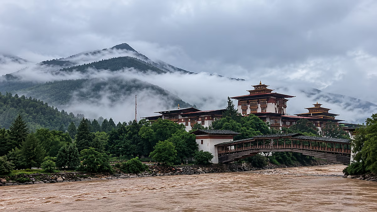
Shintaphu Lake Outburst Triggers Flash Floods in Bhutan
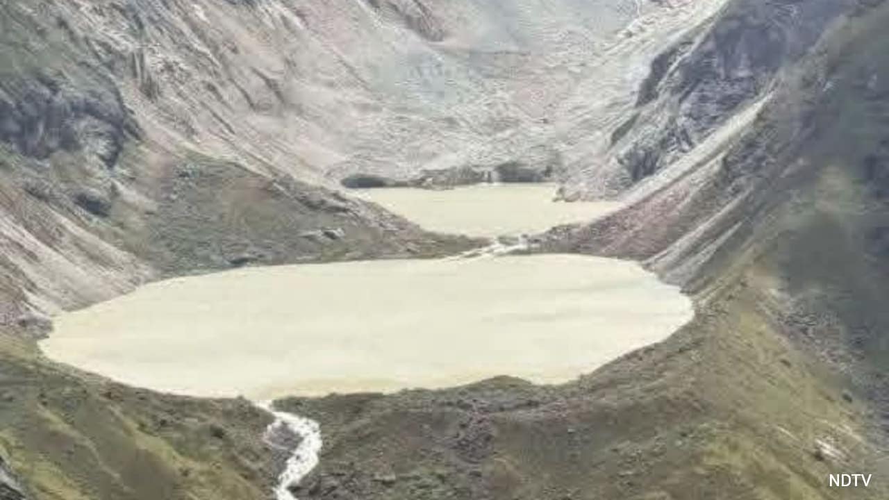
The glacial lake outburst flood (GLOF) was reported at Shintaphu Lake, also known as Shintaphu Tsho, located below Wakila Mountain in Bhutan's Gasa district. The lake lies in the upper reaches of the Mo Chhu river basin and is among 17 glacial lakes in Bhutan identified as potentially dangerous.
According to initial reports, approximately 7.4 million cubic metres of water surged out of the breached lake, creating a significant downstream flood threat. The powerful flow damaged infrastructure in the surrounding region, including facilities at Gasa Tshachu, a popular natural hot spring situated near the Mo Chhu River.
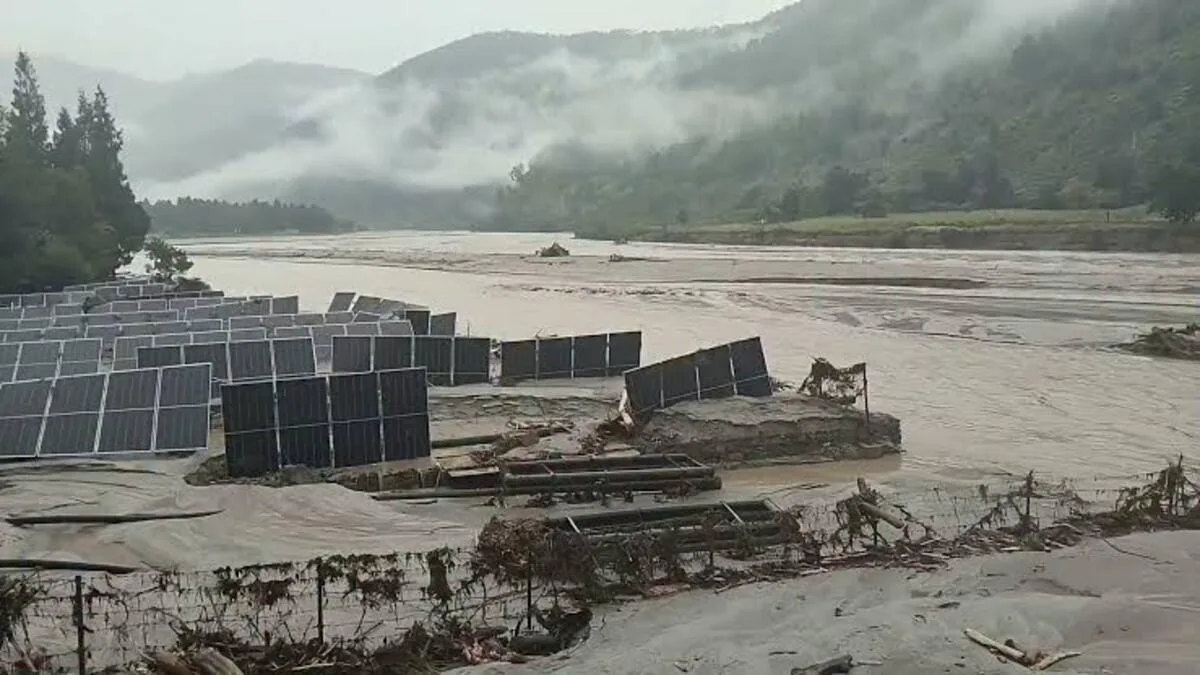
The flood also partially damaged a solar-powered irrigation system installed earlier this year in the Dochhukha-Dzomlingthang-Ritsa Chiwog area of Punakha. The system, designed to address local water supply and irrigation problems, reportedly stopped functioning following the incident.
In addition, floodwaters swept debris onto a section of the Punakha-Gasa Highway near Dzomlingthang. Parts of the road leading towards Laya village were also reportedly washed away, leaving the route impassable. Two Bailey bridges were feared to have been damaged or swept away by the powerful water flow, although the full extent of the destruction remained unclear.
Fortunately, no casualties had been reported in Bhutan in the initial updates. The Gasa Tshachu area had been evacuated before the floodwaters arrived, helping prevent potential loss of life.
West Bengal and Assam Put on High Flood Alert
The impact of the Bhutan glacial lake outburst has raised serious concerns across downstream areas of West Bengal and Assam.
As the floodwater moves through the Mo Chhu River towards the Sankosh River, authorities fear a sudden increase in water levels that could threaten settlements along the riverbanks.
The Sankosh River, which originates in Bhutan and enters India before eventually joining the Brahmaputra system, is particularly important in determining the potential downstream impact of the incident.
In West Bengal, alerts have been issued for vulnerable locations across Alipurduar, Cooch Behar and Jalpaiguri, along with the Darjeeling hills, Terai and Dooars regions.
In Assam, Dhubri district has been placed on alert because of the possibility of a sudden rise in the Sankosh River's water level.
A special advisory from the Union Ministry of Jal Shakti warned of possible flooding in Alipurduar and Dhubri following reports of flash floods in the upper reaches of Bhutan's river system. Authorities in the affected districts were instructed to closely monitor water levels and take immediate precautionary measures.
Officials initially estimated that the flood surge could reach the India-Bhutan border within approximately six to eight hours, although the timing of its movement remained subject to changing river conditions.
Over 10,000 People Evacuated as North Bengal Steps Up Preparedness
With the possibility of flooding increasing, the West Bengal administration initiated large-scale evacuation operations in vulnerable riverbank settlements.
More than 10,000 people have reportedly been shifted from potentially affected areas to safer locations. According to Alipurduar Superintendent of Police Amit Kumar Shaw, approximately 4,000 to 5,000 people were moved into designated shelters, while more than 6,000 others were relocated to safer areas.
Schools, community halls, religious institutions and tea garden facilities have been used as temporary relief centres. In Kumargram block alone, residents were moved to 18 designated flood shelters.
The evacuation drive has been particularly important for communities living close to the Sankosh River and its connected tributaries. Residents in parts of Alipurduar were seen leaving their homes with their cattle and essential belongings following evacuation instructions issued late Thursday night.
Loudspeaker announcements were also deployed in vulnerable settlements, including areas under Rampur-I gram panchayat, urging residents to leave riverbank locations and move to designated shelters.
West Bengal Minister Nisith Pramanik appealed to people living in the Sankosh River catchment areas to prioritise their safety and immediately move away from vulnerable locations. Residents of Tufanganj and adjoining areas of Cooch Behar were also advised to evacuate.
Public representatives separately urged people across the Darjeeling hills, Terai and Dooars to remain alert and follow official instructions.
NDRF, SDRF Mobilised as Authorities Monitor Sankosh River
To manage the potential flood emergency, the state administration has activated disaster management arrangements across vulnerable districts.
Teams from the National Disaster Response Force (NDRF) and State Disaster Response Force (SDRF) have been placed on alert, with personnel deployed or mobilised in sensitive locations, including Tufanganj and Boxirhat in Cooch Behar district.
Civil Defence personnel and local disaster management volunteers have also been brought into the preparedness effort.
Authorities are coordinating with their counterparts in Bhutan to receive updates on the movement and intensity of floodwaters. District officials, police teams and block-level administrations are working together to facilitate evacuations and provide essential supplies.
Relief arrangements include drinking water, dry food and sanitation facilities for displaced residents. Officials have also been instructed to ensure that temporary shelters remain adequately equipped to accommodate people from vulnerable communities.
Alipurduar Superintendent of Police Amit Kumar Shaw has appealed to residents not to panic, assuring them that the administration is prepared and that different agencies are working in coordination.
In Assam, the state government is also closely monitoring the situation. The Dhubri district administration has been placed on alert, with disaster response teams prepared to address any sudden rise in river levels.
An update from the Assam State Disaster Management Authority indicated that the Sankosh River's water level was steady at around 6:30 am on Friday. This offered some reassurance, although authorities continued to monitor the situation.
Floodwaters Could Carry Dangerous Debris
Apart from the threat of rising water levels, authorities are concerned about the debris that could accompany the flood surge.
The powerful flow through the mountainous river system may carry large pieces of wood, concrete and other materials washed away from upstream locations. Officials have also warned that dead fish could be seen in the river as the floodwater moves downstream.
Such debris can increase the danger for riverside communities and damage bridges, roads, agricultural land and other infrastructure.
The India Meteorological Department has also forecast heavy rainfall in Alipurduar on Friday. Additional rainfall could further complicate the situation by contributing to rising river levels and increasing pressure on already vulnerable areas.
Concerns have also emerged over the potential impact on hydropower infrastructure, including the Punatsangchhu hydropower project, a major India-Bhutan joint venture.
What Is a Glacial Lake Outburst Flood (GLOF)?
A Glacial Lake Outburst Flood, commonly known as a GLOF, is a sudden and potentially destructive flood caused by the rapid release of water stored in a glacial lake.
Glacial lakes form when melting glaciers accumulate water in natural depressions, often held back by unstable barriers made of ice, rocks and accumulated debris.
When these natural barriers weaken, collapse or become breached, enormous quantities of water can escape within a short period. The resulting surge can travel rapidly through narrow mountain valleys, carrying rocks, soil, trees and other debris.
Unlike ordinary river flooding, a GLOF can produce a sudden and powerful increase in downstream water levels, leaving communities with limited time to respond.
The Himalayan region is particularly vulnerable to such events because of its numerous glaciers and glacial lakes. Changes in temperature, glacier melting and unstable natural barriers can increase the risks associated with these water bodies.
Shintaphu Lake's identification as one of Bhutan's potentially dangerous glacial lakes makes the latest incident particularly significant for disaster preparedness across the region.
Latest Situation: Flow Intensity Eases, but Red Alert Remains
In the latest available updates on Friday, October 30, the intensity of the water flow was reported to have decreased slightly, offering some relief to authorities and residents.
The administration in Alipurduar said that the situation was under control, with evacuation arrangements in place and emergency teams ready to respond. Later updates also indicated that the immediate flood transition period had passed and residents in the affected Indian areas were safe.
However, the red alert for the Sankosh River system remained in force, and authorities continued monitoring the situation. The full extent of damage in Bhutan was also yet to be established.
The incident is another reminder of how a natural disaster in the Himalayan region can quickly become a cross-border emergency. With rivers connecting Bhutan to downstream communities in India, timely information-sharing, coordinated disaster management and early evacuation remain essential.
For residents of vulnerable areas in West Bengal and Assam, the immediate priority is to follow official advisories, stay away from riverbanks and avoid unnecessary travel through potentially affected routes. Although the easing water flow is encouraging, continued vigilance will be crucial until authorities confirm that the flood threat has fully subsided.
© Copyright 2026. All Rights Reserved. Powered by Vygr Media.